
Avondale Neighbor Block Sources
Public records describe an Avondale block in layers. The parcel map supplies the shape and tax number for each lot. The assessor supplies the owner and a separate tax-mailing destination. A deed confirms the party and legal description in a recorded transfer. Voter data and neighborhood contacts are narrower sources with strict limits. None of them is a household census.
| Official source | Block detail it provides | How to reach it |
|---|---|---|
| Assessor Parcel Viewer | Anchor parcel, adjacent parcel shapes, and APNs | Free map search and polygon selection |
| Assessor property roll | Owner, situs, tax mailing address, deed number, and property facts | Free search by address or APN |
| Recorded Document Search | Deed parties, roles, recording date, and legal description | Free index and unofficial images; paid official copies |
| Arizona voter records | Limited registration fields through lawful channels | One-person service or authorized Recorder request |
| Avondale HOA directory | Community name, manager contact, and sometimes meeting details | Courtesy city list, not a member roster |
Start with the source closest to the question. Parcel tools work for lot position. The property roll answers ownership. The city directory reaches a community manager. A name or mailing address should not be carried from one layer into another without checking what that field means.
Map Your Avondale Neighbors
The Maricopa County Assessor Parcel Viewer supports a small, reproducible block check. It does not publish a “nearby residents” button. Work from the anchor parcel and click only the adjoining shapes needed for the question. Save APNs rather than building a speculative list of people.
- Choose Search By, enter the known Avondale address, and run Search. If the address fails, remove the street-type abbreviation or find it through the map.
- Open Results and select the match. Zoom until parcel polygons around the address are distinct.
- Click an adjoining polygon. Read Feature Information and save its APN, then repeat only for parcels that share the immediate block edge.
- Open each APN in the Assessor property search. Keep owner name, situs, mailing address, legal or subdivision data, and current deed number in separate fields.
- Use the deed number at the Recorder when ownership must be confirmed. Do not treat a lien holder or deed-of-trust party as the owner.
That flow is address to parcel, parcel to APN, APN to owner, and deed number to recorded transfer. The Avondale street directory handles the wider task of following a whole named street.
Measure an Avondale Block Radius
Maricopa County exposes two different map routes, and they should not be confused. The Assessor Viewer documents address, APN, owner, subdivision, MCR, ZIP, and map browsing. Its public help does not document a simple consumer radius button. The underlying parcel service can perform distance queries, but that technical feature is not proof of a visible public control.
The county Flood Control parcel tool is the documented alternate. Its enhanced-search instructions include By Shape, Extent, and a 200-foot point buffer, plus City of Avondale and ZIP layers. Use that tool to define a small area, then return to assessor records for each parcel's official fields. A buffer catches nearby parcels that may not share a boundary with the anchor, while an adjoining-polygon walk answers the tighter question.
County parcel maps are illustrative. They help locate tax parcels but do not settle a survey or boundary dispute. The public parcel service also caps returned and selected records, so a large map pull is both less precise and less useful than a narrow block method.
Note: Label the Flood Control buffer and Assessor Viewer separately because their controls and documented capabilities are not interchangeable.
Separate Avondale Owners and Neighbors
The assessor shows ownership, not everyone who lives on a parcel. Its situs address locates the land. The owner mailing address is where tax correspondence goes. Actual occupancy is a third proposition. A mismatch may point to a trust, a business, a management office, an owner who receives mail elsewhere, or another ordinary mailing choice. It never proves who occupies the home.
- APN
- The assessor parcel number used to identify a tax parcel. It can change after a split or combination.
- Situs address
- The physical location assigned to the property.
- Mailing address
- The destination for owner tax correspondence, which may be different from the property.
- Legal description
- The lot, block, subdivision, MCR, or survey language that identifies the land more durably than a postal label.
Renters and other household members are absent from the parcel roll. A shared owner mailing address across several lots may reflect one company or manager. For a neighbor question, record only the supported fact: “the current roll names this owner for this APN.” Do not turn that statement into a claim about who sleeps at the address.
Note: Matching situs and owner mailing fields can support owner occupancy, but the match alone does not prove it.
Confirm Avondale Neighboring Parcels
The assessor's current deed number is the clean link from an adjoining parcel to the Maricopa County Recorder. A deed result can identify grantor and grantee, recording date, document number, and legal description. “Grantor” is the transferring party, while “grantee” receives the recorded interest. Compare the legal description with the assessor parcel before tying the instrument to the block.
An indexed party can hold a different role. A deed of trust, release, lien, or notice does not make every named party the owner. The recorder provides free unofficial images. Official copies cost $1 per page, and certification adds $3 per document. The Phoenix counter at 301 W Jefferson Street, Suite 200, is open Monday through Friday, 8 to 5, and the office can be reached at 602-506-3535.
When the portal fails, use the county request form, recorder email, fax, mail, or counter with a deed number, party, date, book and page, or legal description. The office preserves permanent real-estate records from 1871, but the recent full-text address mode covers only two years. For nearby parcels, the deed-number bridge is more reliable than a broad address phrase.
Avondale Neighbor Voter Boundaries
Arizona's self-service voter portal checks one registration. It is not an open block browser. Under A.R.S. §16-168, a lawfully supplied voter list may contain full name, party preference, registration context, residence and mailing address, ZIP, a supplied phone, birth year, and prior election participation. Protected registrations are removed, and birth month and day, identification numbers, signatures, and email remain withheld.
The official voter-record statute is the controlling source for any block-level claim.
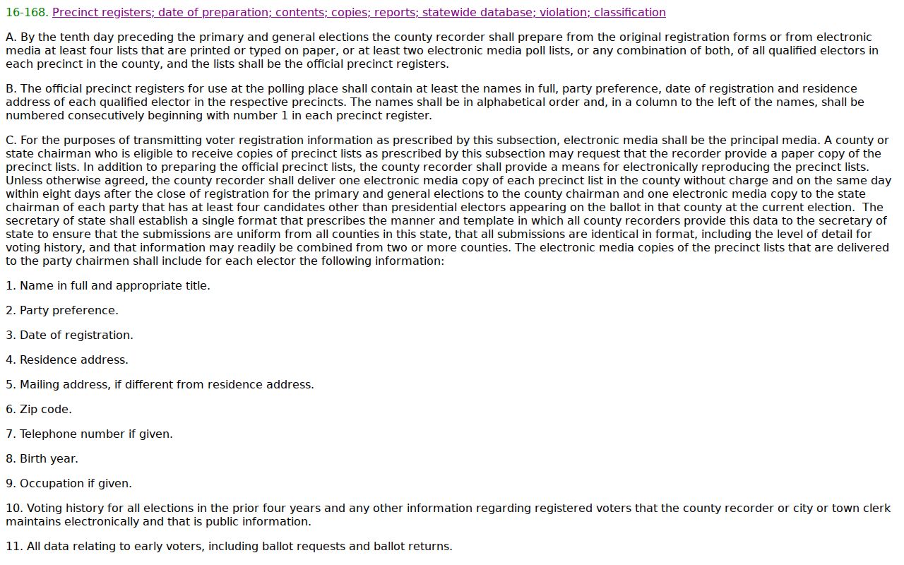
The captured law page reinforces two limits. Election participation shows only which elections a voter took part in, never any ballot choice. A full county file also requires an authorized purpose and certification through the Maricopa Recorder request route. Unauthorized redistribution is barred. Protected addresses and people outside voter registration remain absent from this layer.
Contact Avondale Neighbor Associations
The City of Avondale neighborhood and HOA resource is a community contact layer. It lists an association's management name and contact, and sometimes a meeting time or place. It does not publish member names or household rosters. Use it to ask about a meeting, a community process, or the right management office.
Historic and central areas
City neighborhood geography includes Historic Avondale, Cashion, North Avondale, Palm Gardens, and Rio Vista areas. Check the city list for the current contact where one is published.
Northern communities
Garden Lakes, Crystal Gardens, Rancho Santa Fe, Westwind, and nearby named communities appear in the city's association inventory.
Southern growth areas
Alamar, Tres Rios Landing, Village at Tres Rios Landing, and other southern communities have distinct development and management contexts.
Broader questions may start with the city's neighborhood layer, which exposes 87 named areas. A mapped neighborhood is not necessarily the same as an HOA boundary, postal ZIP, election precinct, or assessor subdivision. Match the exact parcel and subdivision before choosing a community contact.
Note: Association contacts can answer community questions, but the city's courtesy list does not grant access to member records.
Verify an Avondale HOA Entity
An HOA or community manager may be organized as an Arizona entity. The Arizona Corporation Commission eCorp Entity Search accepts an entity name, statutory-agent name, principal name, or entity ID, with optional type, status, name type, and county filters.
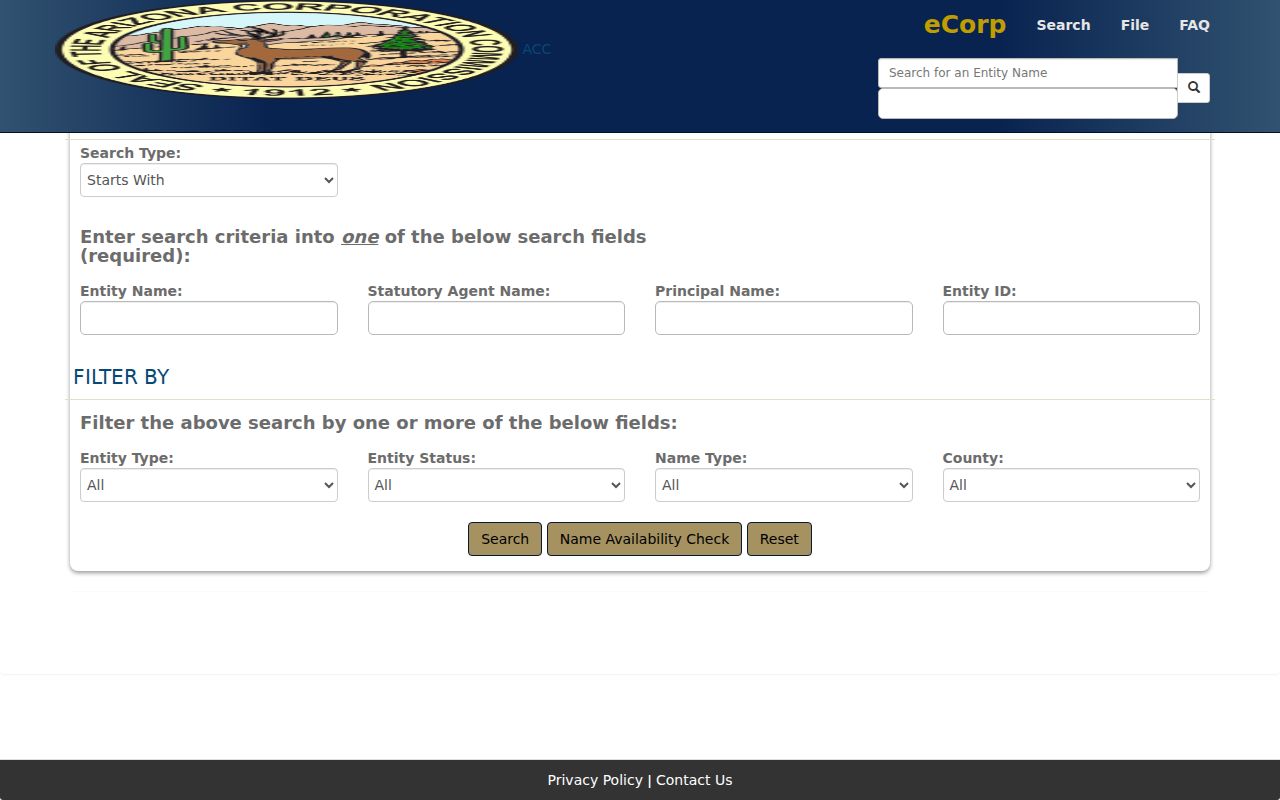
The eCorp result can show entity status, formation date, known place of business, statutory agent, principals, and filing images. Those details can confirm that a named association or manager is tied to a filing. An agent address may be a service or office address, not a home. The entity record also does not replace the city's courtesy directory or prove that a parcel belongs within the HOA.
Use the association's stable legal name from the city listing, then test shorter variants if no exact eCorp result appears. Save the entity ID and status date. If boundaries matter, return to the parcel's subdivision and recorded declarations instead of inferring membership from a similar community name.
Avondale Neighbor Court Records
Avondale City Court hears local civil traffic, misdemeanor, protection, city-code, parking, and property-maintenance matters. A known case can provide public party and event information within retention and privacy limits. The court does not hear felonies, divorce, custody, general damages, or probate. Those files belong with other courts.
The Avondale City Court record request is written and offers view-only access, copies, certification, or audio. Phone requests are not accepted.
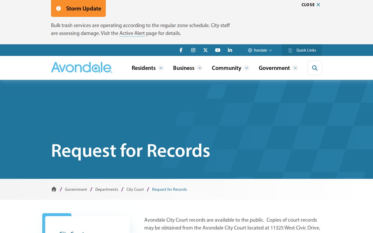
The captured request page points to the official route rather than a broad people search. A request should identify the case or name, case number if known, and the specific document. Name research costs $17 for up to three names or three cases per name; copies cost $0.50 per page. Sealed and protected files remain closed, and older retention limits apply. A court record can document a case, not define an entire neighbor relationship.
Official Avondale Neighbor Evidence
Commercial neighbor tools combine parcels, directories, and purchased data. Their convenience does not cure stale addresses, merged same-name people, or unclear field roles. Official sources are slower because each one answers a narrower question, yet that narrow purpose makes the result easier to verify.
| Question | Official route | Commercial category limit |
|---|---|---|
| Which parcels touch this lot? | Assessor Parcel Viewer polygons and APNs | Map source and update date may be unclear |
| Who owns a parcel? | Current assessor roll, then recorded deed | May retain a former owner or merge an address |
| Who manages the community? | Avondale HOA directory and ACC filing | Contact may be copied without current context |
| Who lives in the home? | No complete official public household list | Cannot lawfully fill private gaps with certainty |
Note: Date every result and preserve its field label because owner, mailing contact, agent, and occupant are not interchangeable roles.
Avondale Blocks Change by Era
Block research works best when it fits Avondale's development era. Historic Avondale and Old Town center on Western Avenue, while Cashion, Las Ligas, and Rio Vista contain older postwar and agricultural-worker context. There, the 1950 census, regional directories from 1949 through 1963, Westside newspapers, deeds, and early municipal history can overlap.
Peripheral agricultural land developed as late as 2005. Newer communities such as Alamar, Entrada, Shadow Ridge, Three Rivers Ranch, and Verde Trails may have strong plats, assessor facts, current deeds, construction records, and HOA contacts but little evidence in the old directory run. The city also reported rapid recent building activity, so current owner and permit data can change quickly.
For a historic block, the 1962 and 1963 criss-cross directories reverse a street and house number into a listed householder and telephone. They are snapshots, not complete rolls. For newer blocks, start with subdivision or MCR, the original plat, and parcel dates. Never force one source across every Avondale neighborhood.
Protect Your Avondale Neighbors
Public block research stops at clear privacy lines. The parcel roll omits renters and household members. Utility and delivery customer lists were not verified as public. Federal motor-vehicle privacy law restricts DMV personal data. Arizona protected voter registrations stay sealed, and the Address Confidentiality Program gives qualified survivors a substitute address and confidential mail forwarding.
New Life Center in Avondale is an official Address Confidentiality Program enrollment assistant at 623-215-8072. Property owners who qualify need the separate real-property protection process under A.R.S. §11-483. Pre-existing recorded documents can require special care. Do not publish a mass list simply because separate records can be joined.
Lawful use. Learn about an Avondale block for civic curiosity, reconnection, or personal safety. Never use records for stalking, surveillance, threats, repeated unwanted contact, harassment, or harm.
A sound neighbor lookup publishes method and record type, not a dossier. When a fact is wrong, contact the assessor, recorder, court, or other custodian that maintains it.